Home
Main Products
Our Main Products
At SkyPath we develop cutting-edge drones for every situation. Please browse our products.
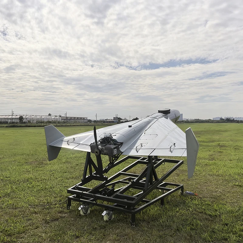
AUS70 Heavy-Duty Integrated C-UAS System
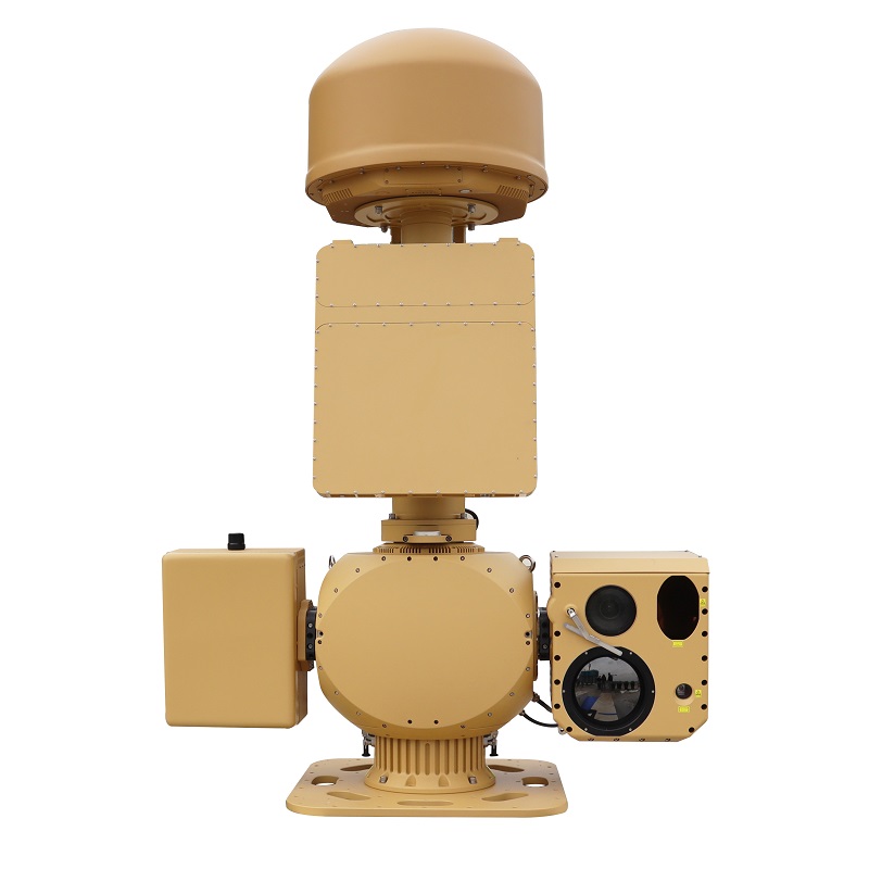
Anti-Drone Jammer Seeker
AD SERIES
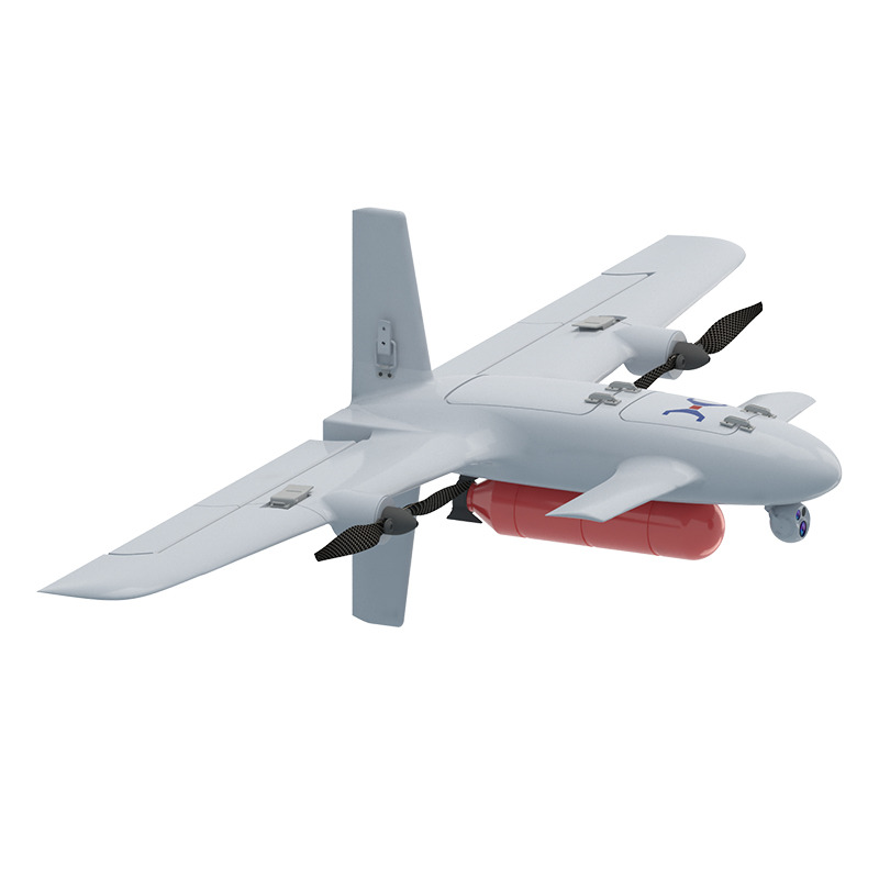
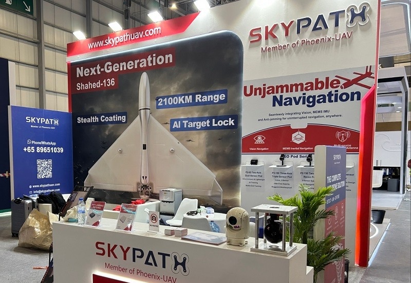
SHADOW STRIKER 3200
PHANTOM REAPER X1500

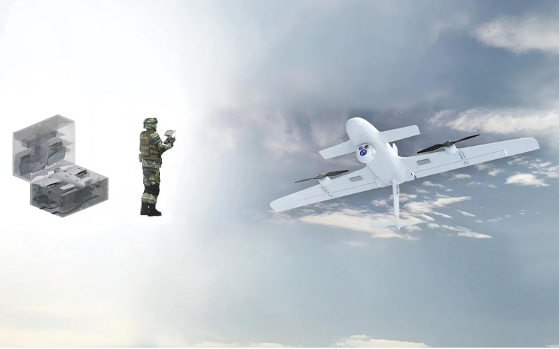
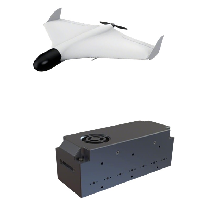
PHANTOM RAZOR 180
About SKYPATH
2500km
Cruise Missile Range
99.9%
AI Target Hit Rate
1000
Drones Produced per Month Best Anti-Drone System
•End-to-End System Delivery
•Advanced Engineering & AI Expertise
•Mission-Proven Applications
Making Tomorrow Different Today.
Advantages
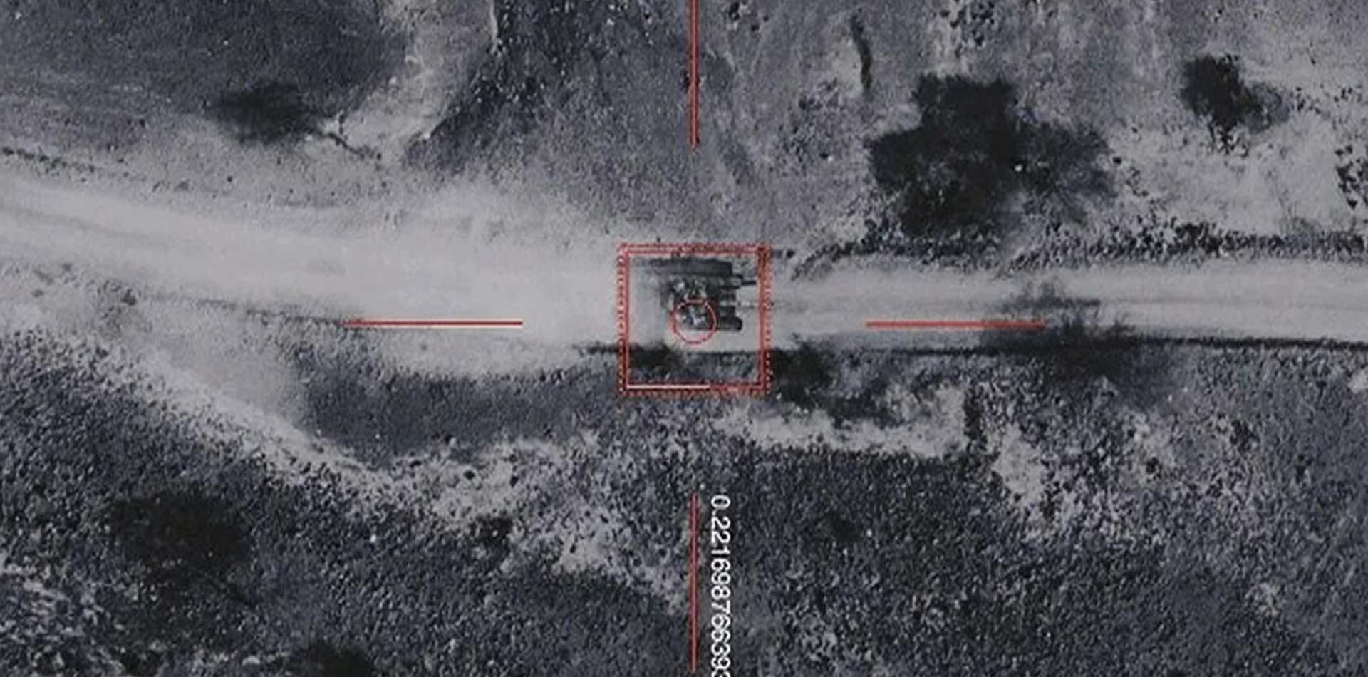
ADVANCED ANTI-INTERFERENCE
STAYING CONNECTED IN CHALLENGING ENVIRONMENTS
In modern defense and emergency response scenarios, reliable navigation and communication are mission-critical—especially in environments where hostile jamming or electronic interference is a real threat. Skypath’s drones are equipped with industry-leading anti-interference technologies, designed to ensure stable operations in GPS-contested or signal-degraded environments. Whether deployed in military reconnaissance, tactical operations, or firefighting missions, our systems provide unmatched resilience and reliability when it matters most.
Skypath drones integrate a GPS + BeiDou four-antenna anti-jamming module, delivering high-precision positioning and robust protection against electronic warfare tactics. This system uses directional signal reception and interference rejection to ensure that navigation remains accurate—even in heavily contested zones.
Robust Signal Resilience
01 Multi-Antenna Anti-Jamming Module
Our quad-antenna setup isolates and filters out jamming signals using adaptive nulling and spatial filtering, allowing only valid satellite signals to reach the navigation system. This significantly reduces the risk of spoofing, blocking, or drifting GPS signals.
02 Dual Constellation Support (GPS + BeiDou)
By accessing multiple satellite systems, our drones improve positioning accuracy and increase redundancy. If one system is compromised, the other can maintain stable location awareness, adding another layer of defense against interference.
03 Inertial Navigation Backup
If GPS signals are lost entirely, onboard Inertial Navigation Systems (INS) maintain flight stability and navigation by using gyroscopes and accelerometers. This ensures continuous operations over short periods in GPS-denied environments, making the platform more autonomous and resilient.
04 Secure Command and Data Links
In addition to navigation integrity, our drones are equipped with encrypted, frequency-hopping communication links to protect control signals and video/data transmissions from interception or disruption. This ensures uninterrupted mission control even in the presence of radio interference or malicious jamming attempts.
SUMMARY
Skypath’s anti-interference technology ensures that mission-critical drone operations continue without compromise, even in highly contested electromagnetic environments. With our GPS + BeiDou quad-antenna anti-jamming module, inertial backup navigation, and secure data links, our drones maintain precision, communication, and control—empowering military and firefighting teams to act decisively under pressure.
AUTONOMOUS CAPABILITIES
IMPORTANCE
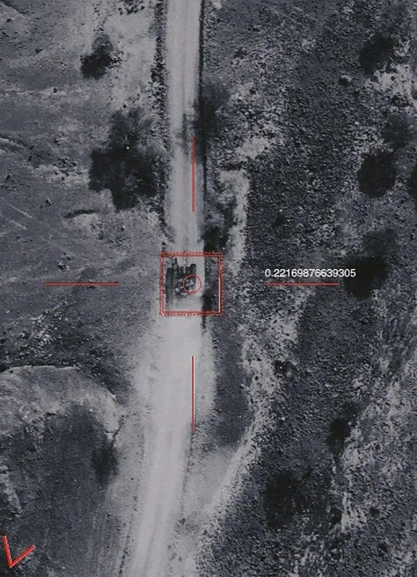
Modern defense and emergency operations often unfold in complex, high-threat environments where rapid situational awareness is critical. From battlefield reconnaissance to disaster zone monitoring, personnel face evolving threats with limited visibility and delayed intelligence. Traditional surveillance methods, often reliant on fixed positions or manned patrols, can be slow, vulnerable, and restricted by terrain or danger zones.
Skypath’s autonomous drone systems offer a transformative solution. Operating beyond visual line of sight (BVLOS), these drones can patrol designated areas independently, scanning for threats, assessing terrain, and providing real-time intelligence back to command units. Whether supporting a forward operating base or coordinating firefighting efforts in unstable terrain, autonomous drones extend the reach of teams without increasing risk to human lives. The ability to deploy aerial assets that self-navigate, adapt to changing conditions, and identify anomalies in real time gives operators a decisive edge in fast-moving, high-stakes missions.
Autonomous Drones
01 Mapping for Mission Planning
Skypath drones bring advanced mapping and terrain analysis directly into the hands of military commanders and emergency teams. Equipped with SLAM and LiDAR technology, our drones autonomously chart unfamiliar or hazardous terrain, generating real-time maps and 3D models critical for mission planning, route optimization, and resource deployment.
Whether you’re mapping a remote conflict zone, assessing earthquake damage, or scanning a wildfire’s spread, these autonomous systems operate without exposing personnel to danger. The drones adjust flight paths dynamically and transmit live updates to command centers, enabling smarter, faster decisions when every second counts.
02 Equipment Inspection in the Field
Defense and firefighting operations often depend on critical infrastructure: mobile command units, comms towers, radar systems, fuel lines. Skypath drones can autonomously inspect these assets, even under duress or in inaccessible areas.
Programmed to navigate complex structures, our drones capture ultra-high-resolution visual data while avoiding obstacles and adjusting for wind or weather conditions. Capable of detecting faults such as stress fractures, overheating, or corrosion, the system feeds this intelligence back to base for rapid triage and response. This proactive, hands-off approach dramatically reduces the risk to field teams while improving asset uptime and readiness.
03 Redefining Operational Efficiency in Piracy Prevention
To tackle this pressing concern, we’ve introduced the Perimeter Patrol feature within our autonomous drone system. This cutting-edge functionality empowers crew members to monitor and investigate vessels approaching the ship, delivering real-time surveillance and boosting situational awareness. Our drone system is equipped with an intuitive interface, ensuring that even crew members with no prior drone experience can easily control and operate the aerial camera. They can effortlessly direct the drone in any direction to keep a close watch on potential threats.
04 Perimeter Patrol for Threat Detection
For military convoys, forward operating bases, or firefighting teams staged in high-risk zones, perimeter awareness is crucial. Skypath’s autonomous Perimeter Patrol function allows drones to continuously scan the surrounding environment, identifying approaching vehicles, persons, or heat signatures.
Designed with an intuitive interface for rapid deployment, even by non-specialist personnel, the drone can be redirected instantly to investigate a suspicious movement or anomaly. With live-streamed video and sensor data, command teams stay fully informed and in control, enhancing security without tying up valuable human resources.
SUMMARY
Skypath’s autonomous drone systems are reshaping modern operations by increasing safety, reducing manpower burden, and delivering critical data at unmatched speed and accuracy. In defense, this means faster threat detection, safer patrols, and better mission planning. In firefighting, it means safer reconnaissance in inaccessible areas and better-informed decisions in high-risk, time-sensitive conditions.
Wherever human presence is too risky or too slow Skypath drones take over, ensuring you maintain the edge when it matters most.
CUSTOMIZED PRODUCTS
OVERCOMING OPERATIONAL CHALLENGES WITH TAILORED DRONE SYSTEMS
In high-stakes defense and emergency response missions, one-size-fits-all UAVs often fall short of meeting unique operational demands. Skypath’s custom drone platforms are engineered to tackle specific challenges—whether it’s securing forward operating bases, delivering critical supplies across contested terrain, or supporting rapid-fire suppression efforts. By adapting airframes, sensors, and software to mission requirements, these specialized systems optimize workflows, enhance safety, and drive mission success under the most demanding conditions.
01 Defense Applications
Surveillance & Reconnaissance
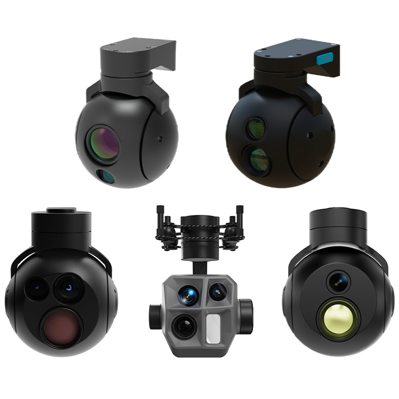
- Modular sensor bays accommodate EO/IR cameras, synthetic-aperture radar, or SIGINT payloads, delivering real-time intelligence over contested areas. Custom encryption ensures secure data links back to command centers, safeguarding mission-critical information.
Tactical Logistics
- Configurable cargo modules let drones shuttle munitions, medkits, or rations to forward teams without exposing convoys to ambush. Automated route planning and obstacle avoidance guarantee timely, covert resupply runs.
Training & Simulation
UAVs fitted with ranging lasers and telemetry kits create realistic, safe training environments. Instructors can script flight profiles, dynamic threat scenarios, and after-action review overlays, accelerating troop readiness with minimal risk.
02 Firefighting & Disaster Response
Hotspot Detection & Mapping
High-resolution thermal sensors and LiDAR payloads generate live heat maps of wildland fires or structure blazes. Custom onboard analytics identify flare-ups and predict fire spread, guiding water-drops and ground crews to critical zones.
Rapid Damage Assessment
After containment, drones equipped with multispectral imagers survey scorched areas, quantify structural integrity, and pinpoint lingering hotspots—all from a safe distance. Data feeds into recovery planning, reducing turnaround time for rebuild efforts.
Payload Delivery
Emergency-drop modules carry radios, first-aid supplies, or lightweight fire-retardant tablets directly to isolated firefighters or trapped civilians, extending support into otherwise inaccessible areas.
CORE CUSTOMIZATION CAPABILITIES
Interchangeable Payloads
Swap high-zoom EO/IR cameras, chemical-agent detectors, or mini-drop canisters on a common airframe to tailor each sortie’s mission profile.
Precision Flight Control
Advanced autopilots support geo-fencing, dynamic waypoint rerouting, and swarming tactics—ensuring reliable, hands-off operation even in GPS-denied or jamming environments.
Real-Time Data Processing & Security
Onboard edge computing nodes process sensor streams instantly, applying AI-driven threat detection or fire-behavior models. Military-grade encryption secures all uplinks and downlinks.
Enhanced Mission Accessories
Add detachable landing skids, deployable flare baskets, or modular light-bars to extend functionality—from night ops illumination to rapid-response beacon drops.
Seamless Software Integration
Custom ground-control stations and API integrations enable mission planners to define flight corridors, automate data pipelines, and fuse drone feeds directly into existing C4ISR or incident-management systems.
SUMMARY
Skypath’s bespoke drone solutions empower defense units and firefighting teams with aircraft purpose-built for their most critical tasks. Through modular payloads, secure data links, and adaptive flight control, these UAVs address the exacting demands of frontline operations—maximizing safety, efficiency, and mission effectiveness in any theatre.

Engineered for Excellence.
Built for Your Mission.
Partner with SkyPath UAV for drones defined by superior quality and unwavering reliability. We deliver manufacturing excellence, ensuring every unit meets the highest standards for performance and durability. Your mission’s success is our blueprint. Reach out to start a conversation and receive a custom quote.

ADVANCED ANTI-INTERFERENCE

AUTONOMOUS CAPABILITIES

ROBOTICS & DRONE CONSULTING
News & Announcements
Recent Articles